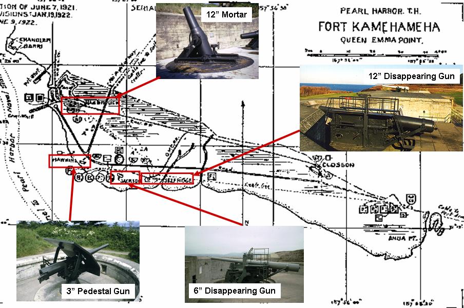
The first step in the internet investigation was to determine what Fort Kam looked like in the 1940s. Google searches on the names of the other military installations on the island (Forts, Ruger, DeRussy and Weaver) eventually turned up a 1922 survey of all the coastal defenses of the United States and territories, including Hawaii.

The map above, from that survey, shows the shoreline, batteries, and major roads of Fort Kam when it was the largest of a group of forts that protected the island of Oahu and was home to three regiments of Coast Artillery. Note the long east-west road, now named Worchester Road, and the north-south road, now named Seaman Road. Fort Kam featured a number of large and medium caliber gun emplacements, or batteries. Four of these, Batteries Hasbrouck, Selfridge, Jackson, and Hawkins, were grouped in the western half of the fort near the enlisted barracks and officers quarters.2 The photographs on the map show examples of the type of guns that were mounted at these batteries. While the guns were removed long ago, the concrete batteries are still in place and would provide important landmarks for determining locations of old structures.
2 Williford, G and McGovern, T, Defenses of Pearl Harbor and Oahu, 1907-50, Osprey Publishing Ltd, 2003

