|
Home
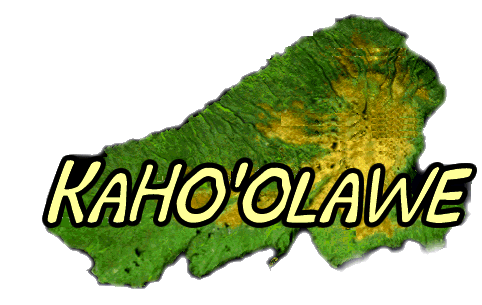
Introduction to Kaho'olawe
PowerPoint
Introduction
Kaho'olawe Surveyor Software
Development Team
Role Cards
Key Elements for Reinhabiting the
Island
Presentation
Assessment
Related readings:
|
Kaho'olawe Internet Resources
Please note:
- will be categorizing the following web sites into sections
of biology (plants/animals), anthropology, watershed, geology,
and other resources)
-will be annotating each site
-will be checking for broken links
- Kaho'olawe
Web page- general information about Kaho'olawe Island
Reserve
- Center
for World Indigenous Studies Home Page
- Kaho'olawe
Kaho'olawe Kaho'olawe It is not too late to preserve and
restore Kaho'olawe's resources;
- Historical
Historical Background Historical Background As one of
the eight major islands, Kaho'olawe lies between Maui, Lana'i,
and Moloka'i. Today, the island retains its cultural significance
as a place for
- Military
Military Use Military Use of Kaho'olawe The island's
first encounter with the U.S. military came in 1841 when
crews from the Leopard and Greyhound--two small vessels
under the command of Lieutenant Bud
- Future
Future of Kaho'olawe Future Use of Kaho'olawe Five decades
of military bombing has left Kaho'olawe with miles of barren
land. The State and Navy has pulled together for a 10 year
beautifying project
- Restoration
Restoration Restoring the Island According to a report
by the Kaho'olawe Island Conveyance Commission, the total
cost for Kaho'olawe's restoration, including the clearance
and removal of unexploded
- Kaho'olawe
Island Reserve on the Topics of Interest
- kaho'olawe.html
By: Jon K. & Kulia W. Kaho'olawe is located seven
miles off the south coast of Maui and seventeen miles southeast
of Lana'i. There are also bays, and they are Kanapou Bay,
Waikahalulu Bay, Hanakanaea (Smugglers) Bay, Kealakahiki
Bay and Kaulana Bay
- mauico.html
Lana'i is known as "the pineapple island", while Kaho'olawe
is known as "the dust bowl" or "the target island". All
the islands in Maui County lie on a platform called Penguin
Bank located 500 feet below sea level; so if the sea level
were to drop 500 feet, then Maui County would become one
large island
- Kaho'olawe
20 Miles Activities Owners Association of Hawaii (Over
60 Attractions)
- University
of Hawaii
- http://www2.hawaii.edu
- http://www.hawaii-nation.org
- List
of
- Hawaiians
Return to the Nation of Hawai`i Home Page , the Kahale
Smith Memorial Page or the News Articles Index Hawaiians
angered by fiery death on Kauai They're outraged at eviction
action Honolulu Advertiser Saturday, January 20, 1996
- Hawaii
Education
- http://www.kauai-hawaii.com
- http://www.bishop.hawaii.org
- Land
not at all well divided. Of the state's 6,425 square
miles of land, the six main inhabited islands make up 98
percent of it. (This figure does
- http://www.hawaii.edu
- The
The Hawaiian Archipelago Ka Pae `Aina O Hawai`i Nei
The Hawaiian Archipelago Ni`ihau, Kaua`i, O`ahu, Moloka`i,
Lanai, Kaho'olawe, Maui, and Hawai`i are the main inhabited
islands of the Hawaiian Archi<
- http://www.hotspots.hawaii.com
- http://nic2.hawaii.net
- Hawaii
Flag: The State Flag has eight stripes (representing
the eight major islands), of white, red and blue; the field
closely resembles the Union Jack of Great Britain, from
which the original flag apparently was designed. The State
Seal has ..
- Virtually
Virtually Hawaii is brought to you by researchers at
the University of Hawaii, Proxemy Research, Inc., Terra
Systems, Inc., Hawai'i and Private Company Sponsors.
- Interpacific
Networks
- Ferd's
Each link will provide you with information about the
island, allow you to view pictures from the island, and
will give you a listing of some sites that are stationed
on each island. So to get on with your Hawaiian Tour click
on one of the islands on the image map below, click the
name of one of the islands listed below, or scroll through
this page to get to all of islands
- Hawaii
Real Estate Information
- Hawaii
Music
- http://www.maui.com
- http://maui.net
- Maui
- Maui
Net
- EVA
VILLA EVA VILLA ON THE SLOPE OF HALEAKALA KIHEI, MAUI.
(THE VALLEY ISLE) EVA VILLA IS LOCATED AT THE TOP OF MAUI
MEADOWS, JUST ABOVE WAILEA, ON THE DRY SIDE OF THE ISLAND.
OUR HOME OVERLOOKS THE ISLANDS OF LANAI, MOLOKINI AND KAHOOLAW
- HOL
- SEDAAR
Outreach:
- http://www.earthwatch.org
- http://www.hula.net
- Internet
- http://www.satlab.hawaii.edu/
Satellite images of Hawaii and the Pacificatellite images
of Hawaii and the Pacific
- Geological
Survey Hawaiian Volcano Hawaii Volcanoes
- http://law.house.gov
- http://www.odyssee.net
- ciesin
home page Thematic Guides to key environmental issues,
including: agriculture. human health. land use. ozone depletion.
political institutions. remote sensing. environmental treaties
and resource indicators (designed to support the ENTRI service).
integrated ...
- http://www.energypeople.com
|
|