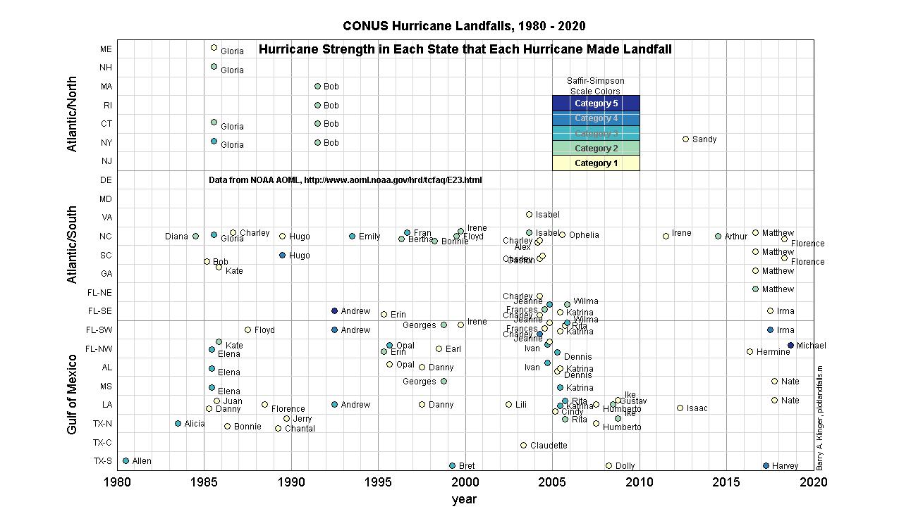
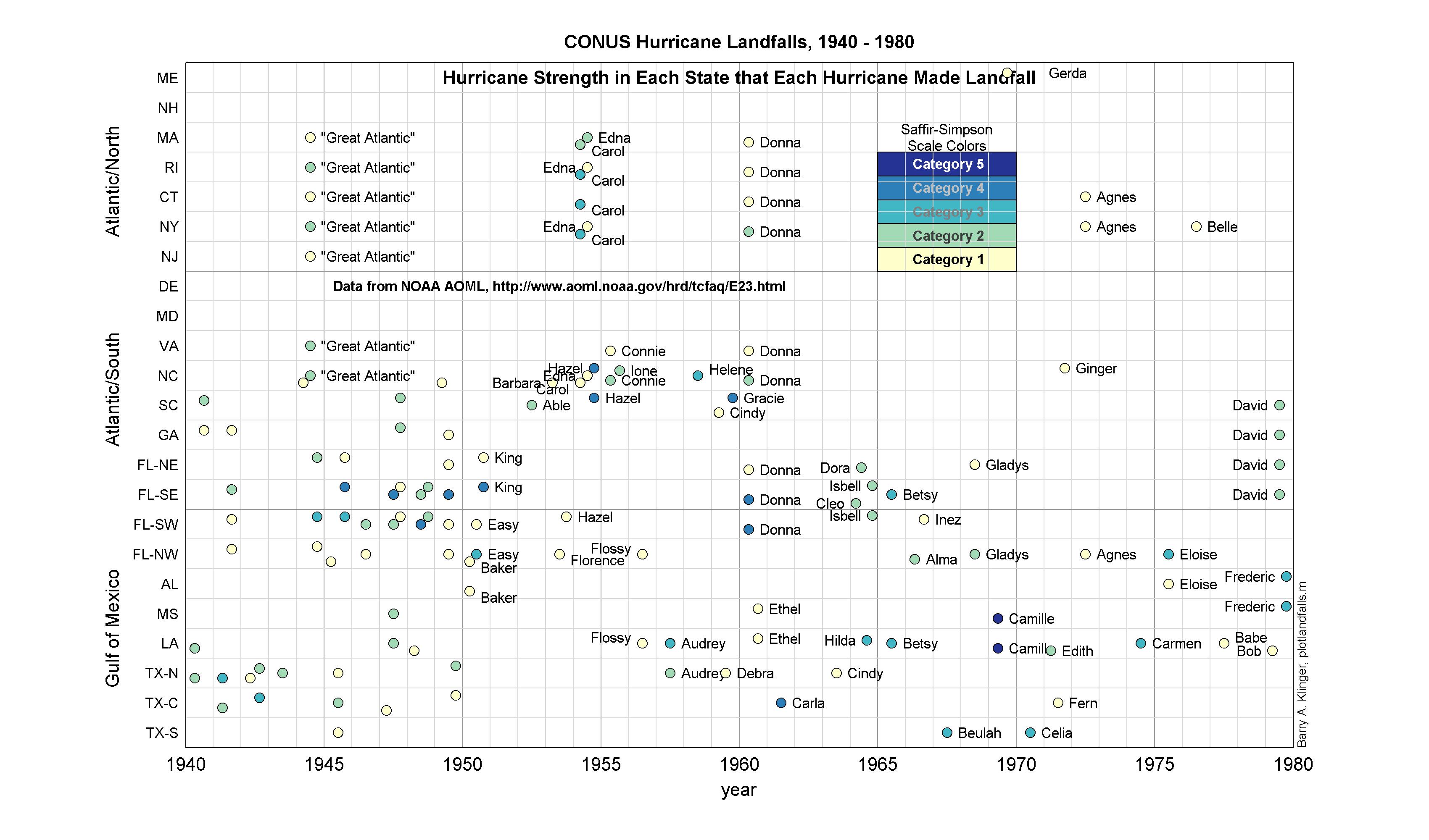
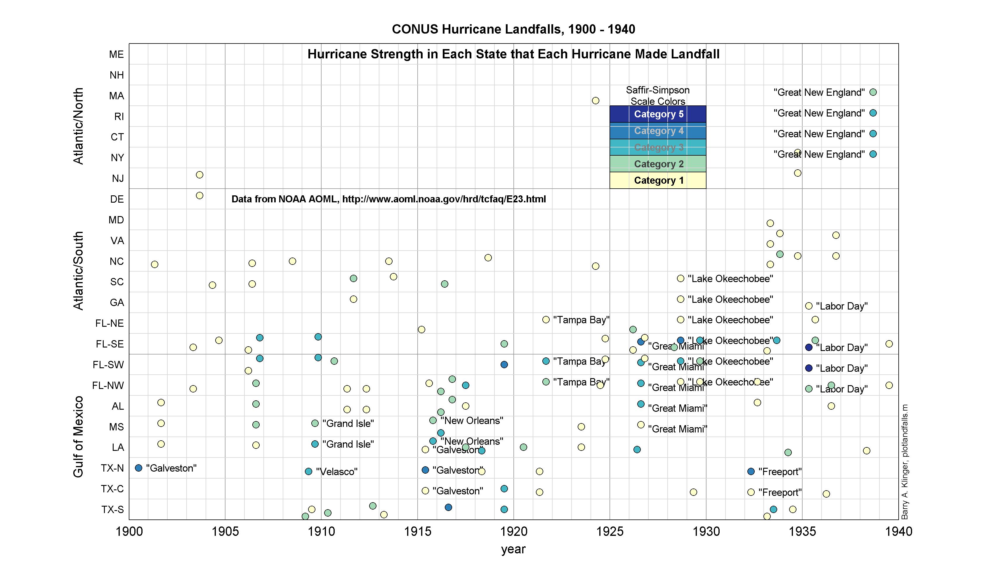
NOAA AOML has compiled a list of hurricane landfalls going back to the 1800s. This list includes the year and (for named storms) hurricane name, as well as each state struck by the storm and the maximum Saffir-Simpson category attained by the storm while it was in that state.
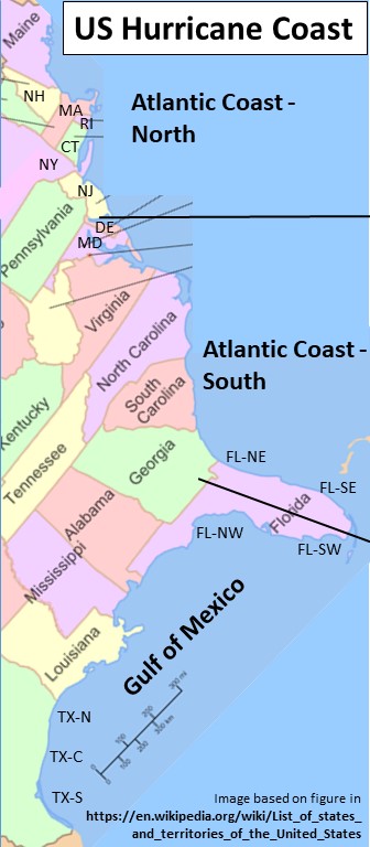
Here I use time-space plots to illustrate the information in the NOAA database. Each dot represents a hurricane. The horizontal location of the dot tells the year of the storm, the vertical location represents the state, and the color represents the intensity. This shows, at a glance, the times and locations of hurricane landfalls in the continental US. Click on figure captions for enlargements and more information.
[June 2019 note: Data for 2018 added from National Hurricane Center archives.]
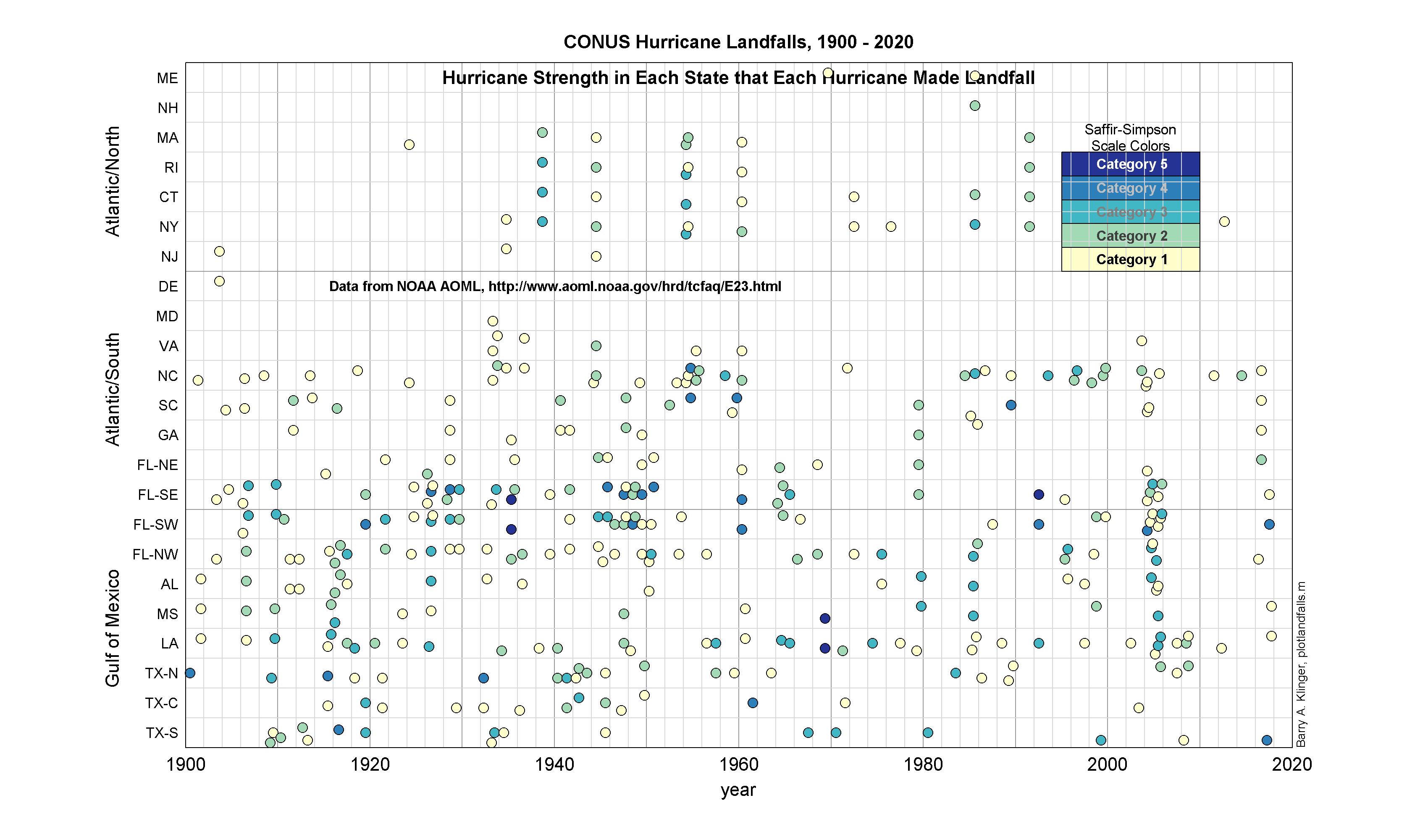
It is also important to note that many hurricanes have struck the Caribbean, including territories administered by the US. These are omitted here because they were not in the NOAA database. It would be interesting to make a similar figure for Caribbean islands, Central America, and Mexico.
Last modified: 9 June 2019