Min Sun
|
|
Welcome to my homepage
I am a PhD student in the Earth Systems and GeoInformation Sciences Program in Department of Geography and GeoInformation Science at George Mason University (GMU) from Fall 2008. I obtained my M.S. degree from GMU and B.S. degree from Nanjing Normal University in China. My major research interests include spatial data quality, WebGIS, GIS modeling, data visualization, mapping and applications in population, public health, environmental science and transportation. My PhD thesis topic is about controlling and displaying data quality in demographical data mapping system. As a graduate research assistant, I have served a lot of projects in the field of mapping data quality, spatial web portal for environmental and climatic data searching, processing, analysis, and rendering.
Contacts
Department of Geography and GeoInformation Science, George Mason University
- Address: 4400 University Dr, Research I Building, Room 255B, Fairfax, VA, 22030
- Email: msun@gmu.edu
- Phone: 571-488-2195
- Homepage: mason.gmu.edu/~msun
Research Interests
- Spatial data and service quality
- GIS modeling, Spatial analysis
- Scientific data visualization, Web mapping, Web GIS
- Population, Public health, Environmental science, Transportation
Research Skills
| Operating Systems: |
Windows, Linux
|
| Programming Languages: |
Java, Java script, PHP, VB.NET, VBA, C, C++, Statistical R, Python, ArcObejct |
| Research Software: |
SPSS, ArcGIS Desktop and Server, MySQL, Eclipse, ERDAS, ENVI, Microsoft Visual Studio, NetLogo, DreamWeaver, Drupal, Liferay |
| Application Software: |
Microsoft Word/Excel/PowerPoint/FrontPage/Visio, Photoshop |
Professional Experiences
Honors and Awards
Publications, Presentations and Books
- Publications
- Presentations
- Book Chapters
Projects
| Project Name |
My Responsbility
|
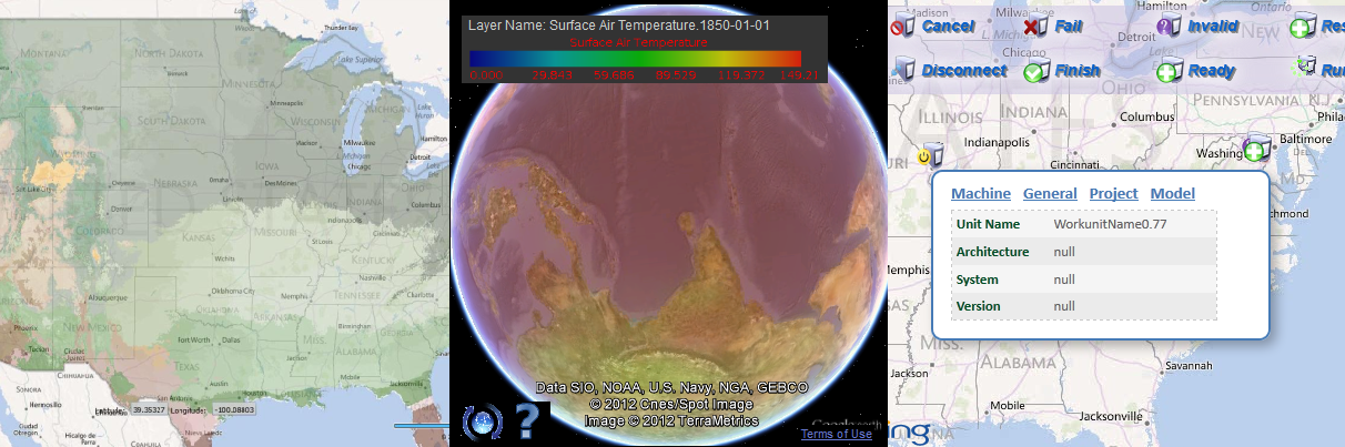
| Climate@Home (sponsored by NASA) |
Developed distributed web mapping and analytical function for climate model outputs with Google Earth
|
| SilvaCarbon (sponsored by USGS) |
Developed online data and file sharing and visulization system with Google Map
|
| Spatial Web Portal (sponsored by NASA) |
Developed geographical data/service search and visulization with Bing Map
|
| ArcGIS Extension for Mapping the American Community Survey (ACS) Data with Uncertainty (sponsored by Census Bureau) |
Degined mapping method and implemented as an ArcGIS extension
|
| ... ... |
|
Professional Services
| 2012 Session Organizer |
Map mashup for public participation GIS: Methods and applications
|
Professional Memberships
| 2009- |
American Association of Geographers (AAG) |
| 2010- |
American Geography Union (AGU) |
Grants
| 2010 - |
ESIP student funding (Geospatial Cloud Processing), $3000 |
GGS772 Homeworks
|